Powered by the World’s Best BIM Viewer, this location-based platform is seamlessly integrated to allow you to work in 2D-BIM on your infrastructure projects.










Developed in collaboration with global infrastructure companies, InfraField meets the complex needs of their projects and simplifies engagement. Users can work with complex 2D and 3D information in a user-friendly way, bringing kilometers of information together into a single touch point.
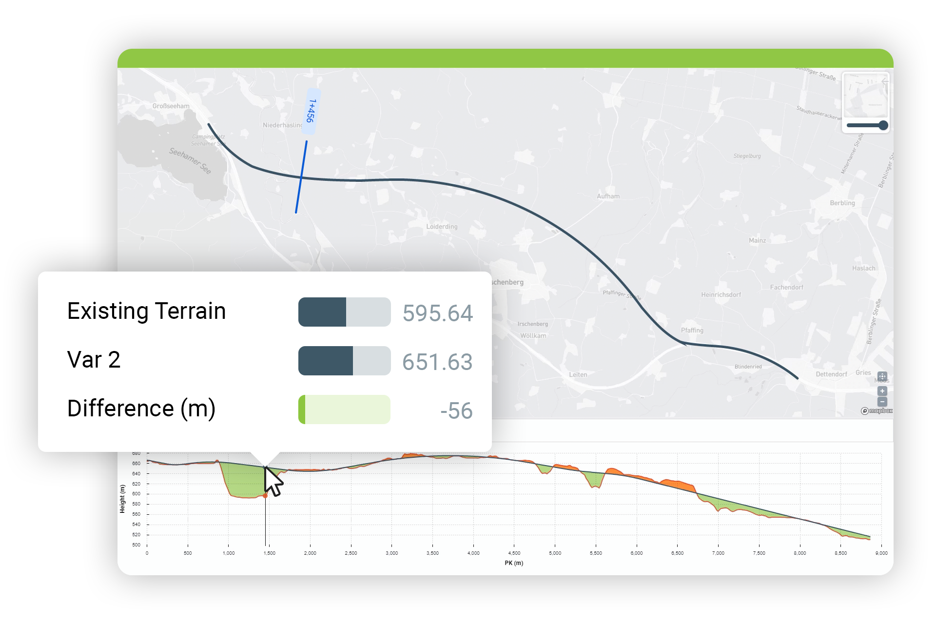

Not just the simple element quantities from traditional structures, you can also get the earthwork volumes to help you plan and manage works on site.
Understand volume differences between 3D surfaces within Dalux, including calculating volumes of stored excavations on site.
Create an interactive visual that shows earthworks along an alignment and quickly see where the cut and fill takes place.
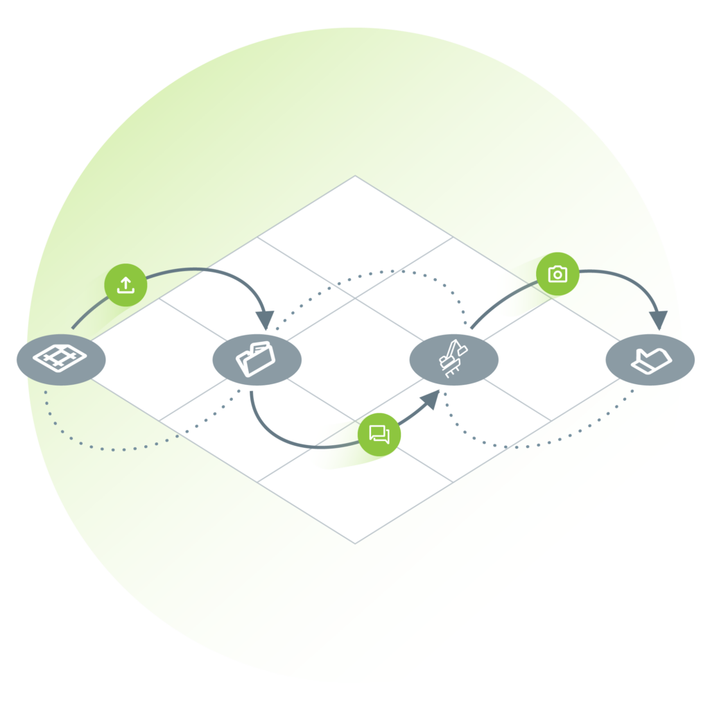
Every part of Dalux is integrated. There are no 3rd party integrations between the quality control system, CDE, BIM Viewer, or GIS system.
Upload information into Box (the CDE) and, once approved, it will become immediately available to those who need it. Or raise a field change request showing the design clashing with GIS data and capture the new as-built location from your site surveyor; all from a single interface.

See your 3D models in the spatial context of GIS data.
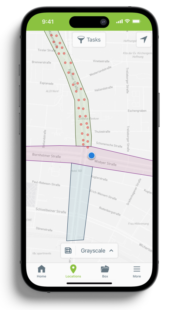
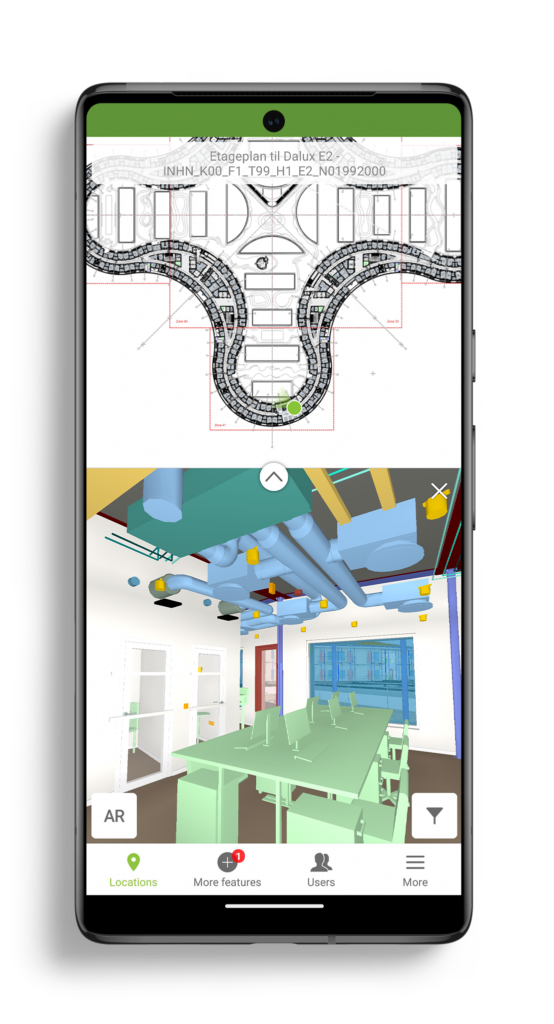
With a consistent map view highlighting your location using your mobile phone’s GPS, you’ll know where you are on a civil or infrastructure project of any scale.
The simple interface also allows users to experience infrastructure projects in a new way and see 3D models in the spatial context of GIS data, bringing immediate value to the construction of linear assets.
Use your GIS data like you would a BIM model and generate checks based on 2D-BIM objects. Drive productivity in repetitive checks, like plate bearing tests. Generate specific checklists at set distances along an alignment and automatically pull in the relevant GIS metadata.
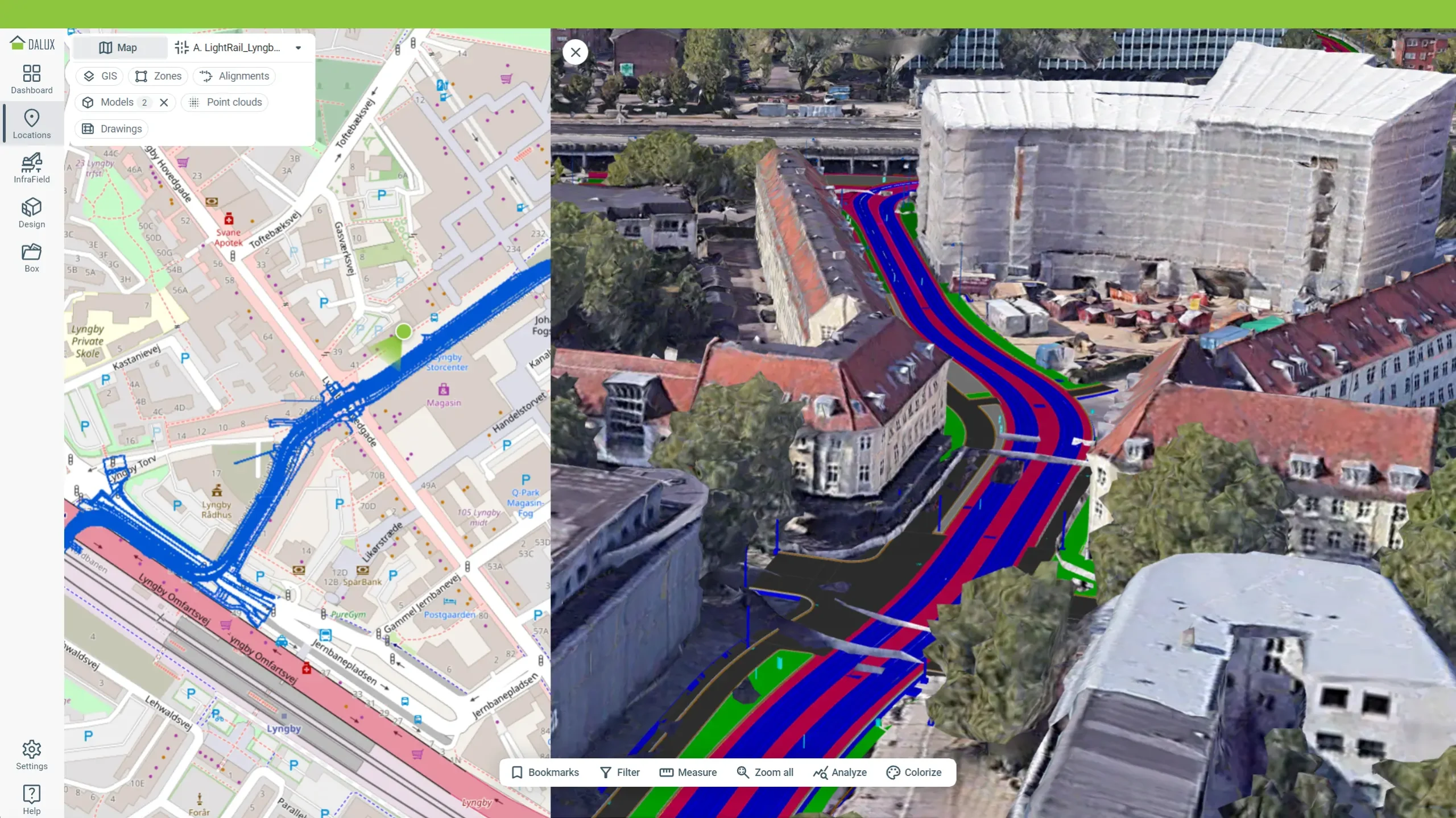
Engage with your design in a simpler way with 3D maps.
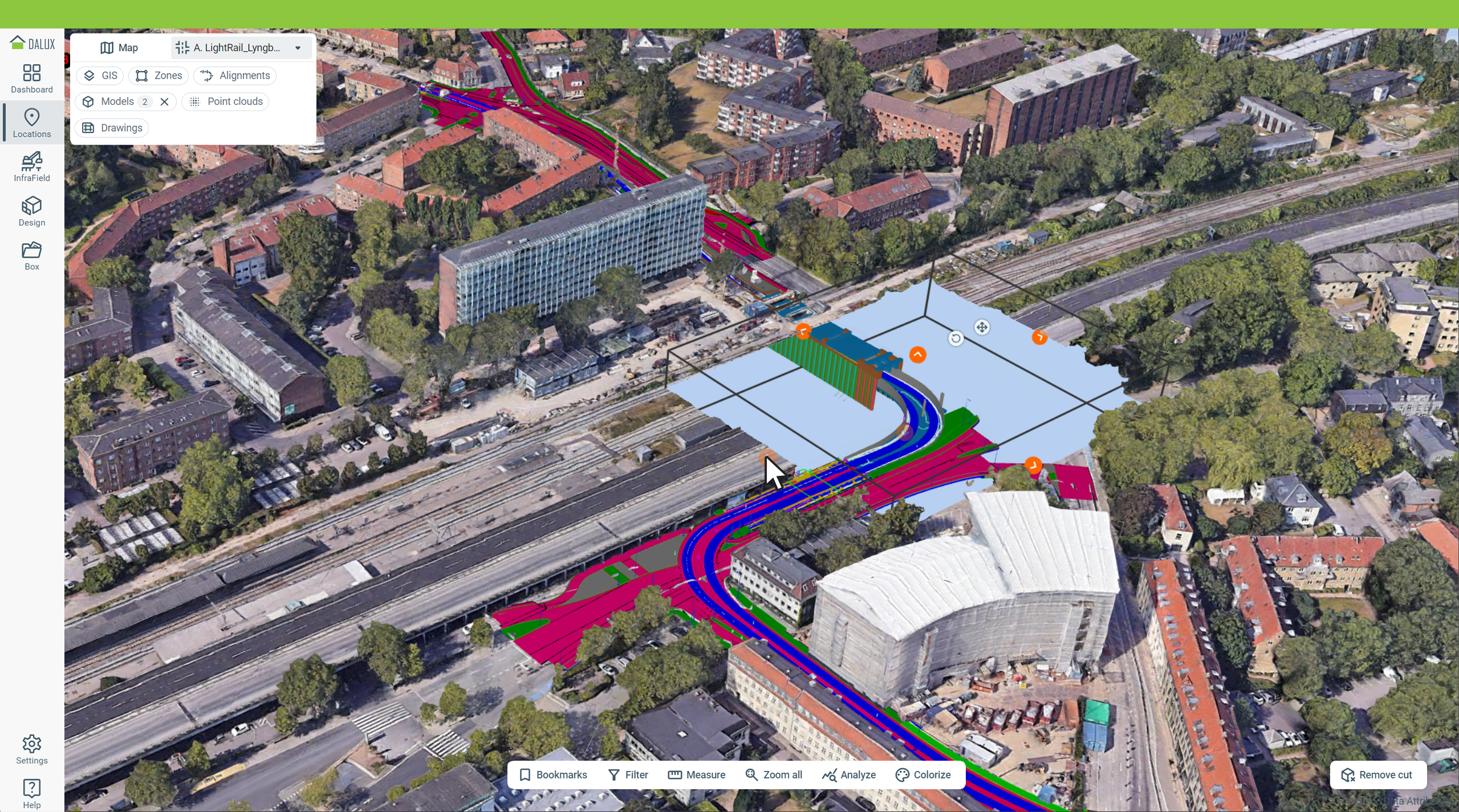
Using Google Photorealistic 3D Tiles, Dalux InfraField will let you see your project in its geospatial context helping to communicate the project design.
See the coverage list of Google Map Tiles.
See the outline of your 3D models on the 2D map, or see your 3D models in their full 3D context.
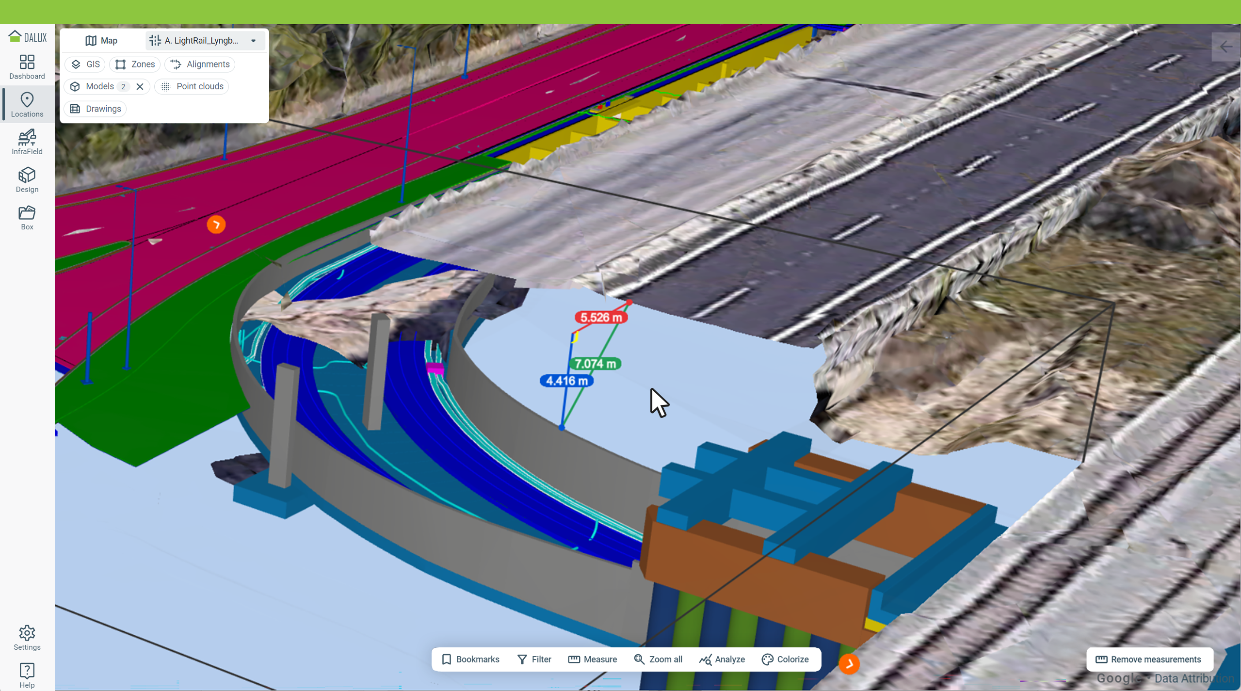
Create an inverse box cut or a section cut along the alignment to fully understand where your project fits in relation to its surrounding.
Perform a quick reference check by using the simple point-point measuring tool. Measure between the Photorealistic 3D Tiles, point-clouds, terrain layers, and your models.
Fill out the form to reach out to one of our employees and they will assist you in getting started.
A BIM Viewer a leggyorsabb és legjobb módja annak, hogy a BIM modelleket az összes projekttag kezébe juttassa, akár az építési területen.
Köszönjük, hogy regisztrált!
Nyissa meg levelezési postaládáját, hogy hozzáférjen a Dalux projektjéhez és befejezze a regisztrációt!
Our BIM Viewer is the fastest and best way to get your BIM models on site and in the hands of all project members.
Thanks for signing up!
Go to your email inbox to access your Dalux project and finish the registration.

Our BIM Viewer is the fastest and best way to get your BIM models on site and in the hands of all project members.
Thanks for signing up!
Go to your email inbox to access your Dalux project and finish the registration.
