Im Infrastrukturbereich spielen neben den BIM-orientierten 3D-Modellen zusätzlich GIS-Daten (u.a. Flurstücke, Adresse) und GIS-Formate (u.a. LandXML, GML, KML) sowie globale Positionierungen eine entscheidende Rolle. Dieses Webinar zeigt, wie sich in Dalux Infrastrukturprojekte mit mehreren Kilometern Ausdehnung bearbeiten lassen und was die Abgrenzungen zum Hochbau sind.
Folgende Übersicht dient als grobe Orientierung über den thematisierten Inhalt:

A BIM Viewer a leggyorsabb és legjobb módja annak, hogy a BIM modelleket az összes projekttag kezébe juttassa, akár az építési területen.
Köszönjük, hogy regisztrált!
Nyissa meg levelezési postaládáját, hogy hozzáférjen a Dalux projektjéhez és befejezze a regisztrációt!
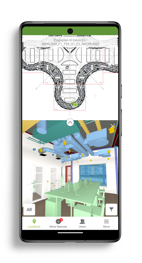
Our BIM Viewer is the fastest and best way to get your BIM models on site and in the hands of all project members.
Thanks for signing up!
Go to your email inbox to access your Dalux project and finish the registration.
Nuestro BIM Viewer es la manera más rápida y mejor de llevar tus modelos BIM al sitio y a las manos de todos los miembros del proyecto.
¡Gracias por registrarte!
Ve a tu buzón de entrada para acceder a tu proyecto Dalux y completar el registro.