- +31 6 25 11 76 85
Dans les projets d’infrastructures, la complexité et l’échelle des travaux exigent une gestion pointue.
L’intégration des Systèmes d’Information Géographique (SIG) et la géolocalisation dans les outils digitaux optimisent les projets d’infrastructures en améliorant la gestion de projet, le contrôle et la sécurité.
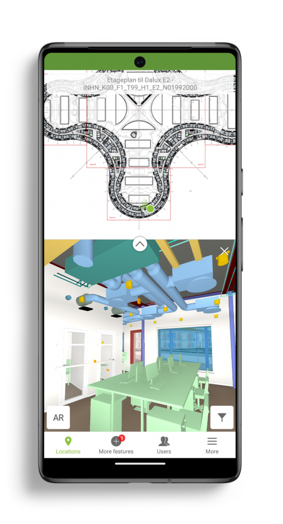
Pendant cet échange, nous allons vous présenter Dalux InfraField qui permet d’avoir une localisation en temps réel en mobilité et de suivre l’avancement du chantier, facilitant ainsi la coordination et l’efficacité opérationnelle.
Au programme :
– Visualisation d’un projet d’infrastructure : plans 2D et modèles 3D
– Visualisation des données SIG
– Géolocalisation de vos projets
– Gestion d’un projet d’infrastructure en mobilité


Our BIM Viewer is the fastest and best way to get your BIM models on site and in the hands of all project members.
Thanks for signing up!
Go to your email inbox to access your Dalux project and finish the registration.

Onze BIM Viewer is de snelste en beste manier om je BIM modellen op locatie te krijgen en beschikbaar te stellen voor iedereen binnen je project.
Bedankt voor je aanmelding!
Ga naar je Inbox om toegang te krijgen tot je Dalux project en om de registratie te voltooien.
